Road centerlines and simple closed building outlines are sourced from OpenStreetMap. Mapped height or building-level tags are used where present. Missing heights are estimated; very tall buildings and façade detail are simplified for performance. Complex multipolygon buildings and courtyards are not reconstructed in this prototype. Road widths default to estimates when missing.
Terrain is sampled from Mapzen Terrain Tiles using the Terrarium elevation encoding, interpolated onto a game mesh and normalized to the selected center. Pixel spacing is not source accuracy. Sources vary; much global data is tens-of-metres resolution and may be dated. Terrain can capture neighborhood slopes but cannot reliably identify individual foundations, doors, retaining walls or split-level floors. A building floor is treated as a level plane at the highest sampled ground in its footprint. Downhill leftover under that plane is filled with earth if it is less than one storey (~3.2 m); extra storeys are added when the drop allows. Doors face the nearest mapped road or path and are never below ground at the opening; a stair is added when the approach is a partial storey lower, because the buildings are meant to be entered. Generated stairs use Israeli dimensional rules as a game approximation: riser 10–17.5 cm (up to 20 cm on public buildings), tread at least 26 cm, 2×riser + tread ≈ 62 cm, private width at least 80 cm (90 cm public outdoor, 110 cm residential/protected), rails 90 cm along the flight and 105 cm on landings. That is not a certified design. When a mapped fence rings a house and the DEM shows about a half-storey drop, the yard between fence and house is raised to house level as an educated guess. Missing elevation produces an explicitly labeled flat fallback.
Parks, forest and water patches use OpenStreetMap landuse, leisure and natural ways when those rings are closed. They tint or overlay the draped ground. Mapped barrier ways (fence, wall, hedge) and tree nodes are placed as game objects; extra trees are scattered on forest and park patches. They are not surveyed plantings. All windows, doors, roof fixtures, façade materials and enemy placements are generated for gameplay. Generated character and weapon art is illustrative. This is a fictional game using geographic data, not a survey, navigation product or representation of actual occupants.
© OpenStreetMap contributors. Data licensed under the Open Database License (ODbL) 1.0. Bundled extracts were retrieved September 2026. Contributor account metadata was removed; coordinates and tags were retained for supported way types, barrier ways, and tree nodes.
Download the underlying extracts: Selected coordinates, Tel Aviv. These extracts and their supported geometric transformations remain available under ODbL. Custom-coordinate requests are sent to the public OpenStreetMap API; your chosen area is therefore disclosed to that service. The game does not request your device location.
Mapzen Terrain Tiles on AWS, accessed September 18, 2026. Full source attribution and license information. SRTM, GMTED2010 and United States 3DEP terrain data courtesy of the U.S. Geological Survey. European terrain data produced using Copernicus data and information funded by the European Union — EU-DEM layers. Global ETOPO1 terrain data: DOC/NOAA/NESDIS/NCEI, National Centers for Environmental Information, NOAA, U.S. Department of Commerce.
Additional providers for custom locations: ArcticDEM DEMs created from DigitalGlobe imagery and funded by NSF awards 1043681, 1559691 and 1542736; Australia © Commonwealth of Australia (Geoscience Australia) 2017; Austria © offene Daten Österreichs, Digitales Geländemodell Österreich; Canada contains information licensed under the Open Government Licence — Canada; Mexico: INEGI, Continental relief, 2016; New Zealand Copyright 2011 Crown copyright, Land Information New Zealand and New Zealand Government, all rights reserved; Norway © Kartverket; United Kingdom © Environment Agency copyright and/or database right 2015, all rights reserved.
Three.js r170, GLTFLoader, BufferGeometryUtils and SkeletonUtils — MIT license. Textured Vanguard/Soldier character and animations from Mixamo, distributed in the official Three.js example. Mixamo permits use of characters and animations in games. The asset is included as part of this game, not as a standalone asset product. The original AI-generated atlas supplies overhead sprites. First-person weapons are illustrative game geometry with barrels aligned to the crosshair target.
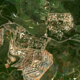
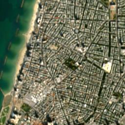
EOxCloudless by EOX IT Services GmbH (Contains modified Copernicus Sentinel data 2020–2025). Creative Commons Attribution-NonCommercial-ShareAlike 4.0. Imagery is included for this private, non-commercial game. The imagery remains under that license; commercial use requires an appropriate separate license. The loader asks EOX for the newest public cloudless mosaic first (2025, then 2024, 2023, 2020) at native zoom 14, which is the finest tile matrix EOX publishes and matches Sentinel-2 RGB (~10 metres per pixel). The same tiles are draped on the 3D terrain mesh and shown on the minimap with a player marker. A repeating procedural grain is multiplied on the ground so walking-scale pixels are not a flat smear; that grain is not photographic. Native imagery is still about 10 metres per pixel, so it is less detailed than high-resolution aerial photography. Imagery dates and OSM mapping dates may differ.
Bundled fallback tiles (2020 mosaic, used only if live EOX is unreachable): Selected area, Tel Aviv. Other locations request tiles from EOX, subject to coverage and service availability. No Google Maps or Street View imagery is collected, analyzed, or included.
You can also build a stage from a north-up aerial photograph you provide. Enter a map scale such as 1:500 or 1:3000 (1 is constant) and the coordinates of the photo centre. The photo is sized from that scale, then matched to the Sentinel-2 mosaic at those coordinates so the two layers line up; OpenStreetMap outlines and elevation stay as the hard map. That file stays in your browser; it is not uploaded to a third-party map service. Photo-derived geometry is an educated guess, not a survey. Do not use imagery you are not allowed to copy. Official GovMap / Survey of Israel tiles are not fetched by the game.
Coordinates default to a checked playable area. Other coordinates are loaded live and depend on external service availability and mapping coverage. Doors are generated openings you can walk through; some are low enough to need a crouch. Surveyed façades, automatic super-resolution of satellite pixels, and exact floor identification are not implemented. Road markings and surface materials are generated. Sentinel-2 is draped at its native ~10 m/pixel; close-up grain is procedural. Both camera views use the same world. Aim assist can be switched off for manual horizontal and vertical aiming. WASD moves relative to your horizontal aiming direction; looking up does not make the character fly. Space jumps; small upward steps are taken automatically.